Emergency Action Plan – Getting Help to Visitors Quickly
Submitted by: Lake Simcoe Region Conservation Authority
About the Project: The Emergency Action Plan (EAP) at Scanlon Creek Conservation Area was developed for staff and first responders to locate visitors in need of help quickly, within the 300-hectare property. Expanding from existing best practices, visual aids were developed to help visitors to reference their location throughout the conservation area. Together with local emergency service providers, the project team at LSRCA implemented and integrated system of signs, posts and mini-info kiosks for visitors to get the help they need quickly while at the conservation area.
About the Project:
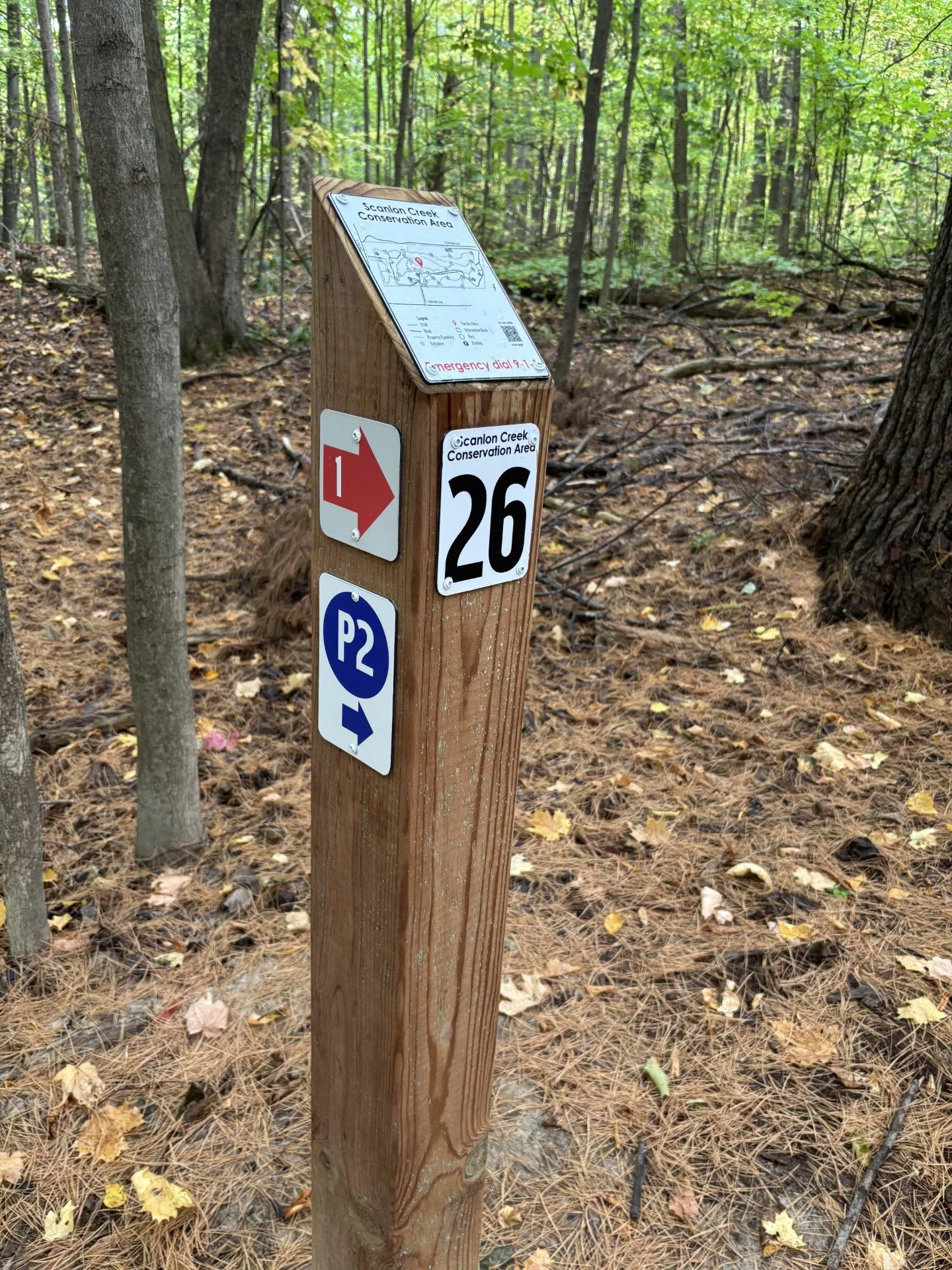
The EAP plan was developed to provide a reference document for first responders to get to visitors in need quickly using any external access road/gate and the internal road network. The visual aids throughout the property support the EAP plan by allowing visitors to locate where they are in the 12km trail network, return to a parking lot or call for help. The visual aids consist of a five (5) part signage plan that integrates with the EAP plan and includes:
911 roadside signs installed at all road access points
External and internal road gates with a unique number and nearest address info
Building/Infrastructure Name signs, installed on all buildings/infrastructure
Get Out Quickly – Posts – unique number, full CA map, direction to next post and parking lot
Mini Kiosk – Includes property map, all post locations, parking lots and trail system details.
Challenge or Issue: One of the top comments in visitor surveys for Scanlon Creek CA was the need for more maps and better trail wayfinding in the trail network. Visitors often said getting lost and unable to return to their parking lot quickly was concerning. In addition, first responders have stated that the trail network is a “maze” to navigate quickly. Improving several levels of signage helps to keep visitors found and the key is the “Get Out Quickly Posts” to support visitors, staff and first responders.
Pillar Category: PEOPLE
The system solutions were an internal success building off the lessons learned by the LSRCA Forestry team that manage the Durham Region Forest - Main Tract, with location posts version 1.0 in that system. The LSRCA Lands team then collaborated with the GIS and Communications team to map and design the sign system. The Emergency Action Plan was vetted with Bradford West Gwillimbury first responders to fine tune their response efforts and link it to their dispatch teams. Finally scenarios were run with the internal Joint Health and Safety Committee to test the system.
Successes and Achievements: While the innovations regarding this project are many, the success is for the People – our CA visitors, staff and first responders safety. By asking for more mapping and better wayfinding, visitors to Scanlon Creek Conservation Area are now able to confidently choose their own adventure on any trail, knowing that the sign improvements will help them return to their parking area of choice quickly if they need to. In the event of an emergency, a visitor is now able to locate themselves within the system using named gates, buildings and/or the “Get Out Quickly” posts, calling in help as needed. First Responders can enter the road and trail systems navigating quickly to trail system entry points each with their own mini trail kiosk locating visitors using the numbered system. In addition, the 12km trail network now has a reference system. Trail inspections, maintenance issues and hazard conditions can now be aligned with the nearest EAP post, improving staff efficiency in addressing challenges. This project solved many wayfinding challenges by looking at the problem differently, not to keep visitors in the trail system through wayfinding, but to help them get out quickly when they need to, while supporting first responders to find our people faster.